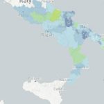
The CMCC Foundation (Euro-Mediterranean Center on Climate Change) announces the launch of a new tool offering future climate scenarios for Italy at very high resolution, based on a “convection permitting” model.[1]
This service provides detailed and interactive maps to explore future climate projections through 22 key indicators, two climate scenarios, and one future period.
The new maps, developed as part of the Highlander project (https://highlanderproject.eu/), allow for simple and intuitive visualization of how climate change could affect Italian territory in the future. These data were developed in the Highlander project to support the assessment of climate impacts and risks and facilitate research in various sectors exposed to such risks.
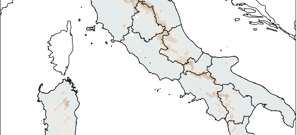
The maps available on Dataclime cover a wide range of crucial climate indicators, such as temperature increase, changes in intense precipitation, and the frequency of heat waves. These indicators are presented for the future period 2036-2065 compared to a thirty-year reference period (1981-2010).
Compared to the maps already available on Dataclime, the new maps offer finer resolution thanks to the use of a climate model with a resolution of 2.2 km.
The data underlying the maps were generated by the CMCC Foundation and are also accessible on the Mistral platform and the CMCC Data Delivery System (DDS): https://dds.cmcc.it/#/dataset/climate-projections-rcp85-downscaled-over-italy/historical
For a more in-depth analysis of the data and methodologies used for data production, please refer to the scientific publication “Very High Resolution Projections over Italy under different CMIP5 IPCC scenarios” (Raffa et al., 2023), available here.
Finally, the maps represent climate variations according to two IPCC scenarios, with the aim of raising public awareness about the importance of climate change mitigation policies.
All maps are available for free download through the Dataclime platform, offering a valuable tool for researchers and anyone interested in studying climate change in Italian territory. It is recommended to consult and respect the disclaimer associated with the use of the maps, to ensure correct and informed use.
[1] A convection permitting climate model is a type of model that simulates the climate at a very high spatio-temporal resolution, typically a few kilometres in terms of spatial scale and hourly in terms of temporal scale. This allows for explicit representation of some atmospheric phenomena, such as thunderstorms, which are simplified or “estimated” in lower resolution models.
In practice, these models are designed to better simulate local phenomena because they can capture the details of atmospheric processes that occur on smaller scales, especially in areas with complex terrain such as mountains or coasts. For further details, please refer to the relevant literature.